Friday, September 7, 2007

1- Introduction

Hello fellow adventurers!
The following 5 posts (#2 to #6) tell the story of the Spanish Donkey's adventure. Please read on at your leisure. Pics are available upon request.


Canoe and Kayak Adventure
from Spanish (on the North Shore of Georgian Bay)
to Ottawa, Ontario, Canada
or
The Travels of the Spanish Donkey Aug 7/07

1- Introduction
2- Georgian Bay
3- The Trent – Severn Waterway
4- The Bay of Quinte
5- The Rideau Canal (175th anniversary)
6- Post Script


1- Introduction

We paddled over 1100 km. in 42 days on the water. We, are 4 retirees from Elliot Lake, Ontario: (aged 59 to 70) Bill and Iris, Gord and JR. Our trip started from Little Current, on Manitoulin Island, down the coast of Georgian Bay to Port Severn. (13 days) Then, we paddled the Trent-Severn Waterway (16 days), along the Bay of Quinte to Kingston (4 days) and then up the Rideau Canal System. (7 days) There were only 2 days that we took-off, one in Peterborough (to see the Canoe Museum) and one in Trenton. (due to bad weather)

The idea of this trip started with Bill, who wanted to connect his two previous trips on the canal systems with a series of “day trips” down Georgian Bay. The other motivation for this trip was to help celebrate the 175th anniversary of the Rideau Canal. “We are the unofficial representatives of the Rideau Canal Anniversary!” Also, we were sponsored by: Elliot Lake Retirement Living (retireelliotlake.com) and by Manitoulin Wind and Wave, Canoe and Kayak Sales and Service, Kagawong, Manitoulin Island. (paddlemanitoulin.ca) The canoe, paddled by Bill and Iris, and the 2 kayaks displayed banners from our sponsors. Perhaps you had seen us on the water. Our own blog site is: http://spanishdonkey.blogspot.com After you have read this article you can follow our postings on the blog. We hope that this trip with inspire other seniors, and juniors as well, to participate in “silent, environmentally friendly” outdoor sports.

We carried with us: a GPS, navigational charts for Georgian Bay, a marine radio and a cell phone. Safety was our Number One, zero tolerance issue. If the winds got over 15 km. or if the conditions were just to hard to handle, we would head for shore. In case of a spill, which always happens in non-ideal conditions, our plan was not to try to make a re-entry but to haul the equipment and paddler(s) to shore with tow ropes. During the entire trip we all wore Salus PFD’s, and skirts on the kayaks. The canoe was outfitted with a skirt that was on for most of the trip. Each kayak and the canoe were packed with their own tent, sleeping/cooking equipment and clothing/food supplies. We encourage anyone who is planning overnight trips to get the right equipment and training. At Manitoulin Wind and Wave, Brian had us try out a number of kayaks and put us in the right kayak for each person. Gord and JR had never kayaked before! This trip was going to be their first mammoth, experience!
Everything went extremely well! There were no tip-overs, the weather was close to paddle-perfect, and no one had to stop due to pain or health. Gord, video taped our journey under mostly gray, cloudy skies. Amazingly, we were only rained on once, on the upper Rideau, near Smith’s Falls. God answered our prayers, kept us safe and kept us humble by causing only a couple of navigational errors.

2- Georgian Bay

2- Georgian Bay

Originally, the plan was to leave Spanish, on June 18 but due to bad weather we postponed the trip to the next day. There were still white caps in Spanish Harbour the following day so we decided to drive to Brian’s (Wind and Wave) cottage, just south of Little Current on Manitoulin Island. On June 20 /2007, “The Spanish Donkey” started off, around Strawberry Island, towards Heywood Island and hopefully, to Killarney for a fish and chip supper. The name, “Spanish Donkey” was really a spur-of-the moment brain wave, created the day before we left, in search of a unique blog spot handle.

The next part of our trip is something we will always remember.
Gord and JR were finding their sea legs. Brian was accompanying us for the first few hours and Bill and Iris were leading the way. There was a moderate chop to the water as we headed towards Heywood but once out past the point and into the full open expanse of Georgian Bay, meter high waves started to roll and break from our starboard side. Gord and JR, in their kayaks, became extremely focused on reaching the shore about 2 km. away. The distance between the kayaks and the canoe started to grow uncomfortable. Brian, with all his skill and experience, was able to hang in the side of the waves and started to teach JR how to brace, to look around and wait for Bill and Iris. As we recalled many times later, this became a comical scene with Brian darting back and forth between the canoe and the kayaks, with Gord and JR fear-driven to get to shore and with Bill and Iris having to stop in mid-storm to put on their canoe skirt. Of course, at the end of the day, Gord and JR were cool and relaxed and Bill and Iris said they didn’t want to set a fast pace for the beginning of our adventure. However, this experience taught us a valuable lesson: we should always stay together and within shouting distance.

We all were becoming accustomed to our boats and began to appreciate how well they handled in winds. Never once during the entire trip did the loaded kayaks feel that they were going to turn over. Gord’s kayak was a Wilderness System, 17’-0” Cape Horn, which had the unusual habit of nose diving into the waves. JR’s was a Wilderness System, 16’-0” Tsunami, which would ride and surf over the waves. Bill and Iris paddled a 15”-8” Swift, Mattawa which they have taken on many previous trips. The were able to handle, “Matty,” with skill and grace. The endless argument of which was the better craft (canoe or kayak) was always in the background as we traveled on. Fortunately, we were not able to solve this conundrum.

On the way to Killarney, instead of Landsdowne Channel being a protected shelter, it had turned into a 30 km. wind tunnel. Most of the time we asked each other, “well what do you want to do, well, what do you want to do?”
After a long break, (tea for Bill and Iris) and with the dying wind in our back, we pushed on, made camp at the Killarney Marina and finally had our fish and chip supper. This was our first days’ introduction to Georgian Bay. At times, when you wanted to put your paddle in the water, there was no water there! The boat was either sideways on the crest of a wave or was surfing between white caps. Our novice kayakers soon learned to trust their craft, stay balanced and have fun.

The next section of Georgian Bay was wide open to big water. The wind was moderate but rain clouds were threatening our progress. At one point, we stopped and set up the shelter. (Bill had brought a good sized dining room/kitchen tent that could be set up quickly in emergencies) There are so many small bays and rock outcroppings along the northern part of the Bay that it makes it very easy to get off rough water. The storm passed us by and we were on our way to Collins Inlet. The Inlet was a beautiful paddle through coniferous trees and granite rock. At one point we saw a bear cub swimming across the water. He turned back when he heard us coming and ran away into the woods.

Normally we were up at 5:00 a.m. and on the water shortly after 6:00 a.m.
At around 2:00 p.m. we would start looking for a camp ground. Camps were easy to find along the barren rock on crown or reservation land. Our aim was to paddle, on average, 25 km. a day. Under good conditions we were doing over 5 km. per hour. On the next day, the wind was against us and we took shelter on a large sandy beach in Sugar John Bay. However, we were back on the water by noon and made our daily quota before the next camp. Next on the itinerary were the Chickens. The Chickens should be one of Canada’s seven wonders! These islands are composed of hundreds of colourful, barren rocks with narrow inlets and dead-end passages in between. We could of spent the entire day exploring their beauty and ancient mysteries. The next big challenge for the, “Donkey” was to get around desolate Popham Point and Point Grodine. Here the landscape changed to barren rock and the lonely call of the loon echoed off the dark water. Because the main channel veers away out into the Bay, this area is extremely remote and can only be visited by paddle craft. Our camp that night was on empty rifts of flat, warm rock.

Now, I’d like to describe, “the incident.” The incident was continuously brought up by Bill and Iris whenever they wanted to rib the greenhorn, JR. JR got stuck on a rock. He thrashed and paddled the water into a whirlwind of white foam. Bill tried to pull the kayak off the rock with a tow rope but JR was stuck, tight and secure. Eventually, Bill got out of his canoe and pushed JR off the rock. From then on, we all were especially concerned about becoming stranded on the rocks. Iris, in the front of the canoe, would pick the way through the shallow shoals and Gord and JR would follow in a single file behind. The next day, Bill and Iris also got stuck on a rock!

The water was as smooth as glass. We sailed on past the French and Pickerel Rivers in the morning on our way to Key Harbour. Key Harbour was a perturbing change where we actually saw other boats, cottages and people.
Further on, again out amongst remote rock and gray sky, we met 2 lone canoeists, John and Stephanie. They were headed west, eventually to Thunder Bay, doing a 2 year environmental study of the Great Lakes. Gord used to shop at the same outfitter’s store in Kitchener where they both worked. What made the biggest impression on them were the small collapsible chairs we carried to relax in while having lunch or watching the sunsets. With the wind in our back and a light chop to the water we made good time, for the next two days, down the coast to Pointe au Baril. Here, at a friend’s cottage was waiting a chicken and chili dinner complete with a double layer cake and raspberries. For our own meals, supper altered between rice or pasta with a few vegetable flakes or dehydrated packs thrown in. We ate a lot of prunes, dates and dried apricots. Raisins and peanut butter were the main course for lunch. Whenever we could stop at a corner store we stocked up on fresh fruit, beans and ice cream.

Shawanaga was a different story. Heavy seas were being thrown at us from all directions. We just got camp set up on some flat rocks as the thunder rolled in and the winds picked up considerably. Our tents would have been blown away if not for a line of rocks along the fly. In the morning we started out again in white capped waves and with the wind against us. Shawanaga wouldn’t let go. After recuperating for awhile in a few protected bays, it was, “here we go again,” out into the rolling, white and blue until we could get around the next point and hopefully, a change of wind direction. Snug Harbour and Killbear Park were a welcomed relief. At the Park we were able to unload right at a waterfront campsite. On the next day, by the time we got into Parry Sound the waves were again whipping at us from all sides. In Parry Sound Bay we underestimated the distance that we traveled and Gord and Bill had to take a compass bearing to get us back on track. We camped at the OPP Marine and later walked into town to have a well deserved meal at Don Cherry’s. Bill will always remember his humongous desert of chocolate ice cream and brownies.

At Sans Souci on Frying Pan Island we enjoyed Henry’s fish and chips. As long as we ate at the diner we were allowed to camp at the marina. Except for a few non-alcoholic, restaurant meals along the way, our summer vacation was very inexpensive. Here, we met a fellow kayaker who was headed out to The Umbrellas on a solo trip. He would be out of the site of land for miles. “Good luck amigo!” Gord and JR were being persuaded by the veterans to name their boats. Gord called his, “Shawanaga” and JR his, “Sans Souci,” which means, “without fear.”

All the islands do look the same. Without our GPS and maps it would be near impossible for a novice to navigate through the, “Thirty Thousand Islands” from Byng/Britt Inlet to Massasauga Park. Many times, we held a conference in our board room to confirm the course and pick out the buoys. The farther we traveled south the harder it was to find a camp that was not on private property. At Go Home Bay we were told there was a camp ground a few minutes up the inlet. After paddling for more than an hour and going through, “the hole in the wall,” we still couldn’t find the spot. Finally, we met a young lad in a power boat who showed us the concealed camp. Here, safe, high and dry, we felt blessed again. In the morning we heard on the marine radio that a storm had brewed up out on the bay and the Coast Guard was calling for help to rescue numerous small boats who couldn’t find anchor or who had tipped over! For the majority of our trip, we had met really helpful people, like the lad above, who understood and commended us on undertaking such a huge challenge. Add to that the tremendous paddling weather we were now experiencing, cool windless mornings and overcast days, our adventure was already a success.

On July 2, Canada Day weekend, we were going through Honey Harbour in the heart of cottage country. The water was churned to a froth by the wake of speed boats racing off in every direction. By now, the kayakers were used to surfing and rolling with the wake. Bill and Iris, having done both the Trent and Rideau Canals before, said that the day will come when Gord and JR would hope for a little dip and dive. Remember, we were now only completing the first leg of our journey. There are still 3 more legs for the, “Donkey” to conquer: the Trent, the Bay of Quinte and the Rideau. Georgian Bay gave us one more blast as we entered Port Severn. However, after paddling more than 360 km. in 13 days down her magnificent coast, we all said we’d do it again.
On a final environmental note: we found the northern part of Georgian Bay to be extremely pristine with no signs of obvious pollution. The water was clear and there was plenty of wildlife. The southern part could be suffering from excessive waste and green-house gases but to the untrained eye, this part of cottage country exemplified the Canadian dream of living with nature beside sparkling lakes and rugged granite.

3- The Trent-Severn Waterway

3- The Trent-Severn Waterway

At Port Severn the Lockmaster and his crew were extremely helpful. When Iris mentioned that she would like to do some laundry, one of the workers volunteered to drive us to the local laundromat. Once we were on the canal system, there were no more worries about finding a camp ground. You are allowed to camp at the locks as long as you come in by boat or bicycle and have paid your fee. However, there are some long stretches and big lakes between some of the locks where you have to find your own spots. We never, “cheeta” once by staying under a roof at an inn or a cottage. Canoes and kayaks are charged the same fee per foot as the large boats for a transit pass and a mooring pass. But, since we always pull our boats out of the water at night, this allows for extra mooring space for other boaters.

The Trent and Rideau Canal Systems are one of Ontario’s best kept secrets. Most people don’t even know that they have this tremendous outdoor resource right in the most populated area of the province. The number of canoers and kayakers you see on the water are very few. The Trent-Severn Waterway is now undertaking a study to improve the use and profitability of the system. However, as far as paddle craft and kayaks in particular are concerned, the main problem with the Trent is accessibility to small boat platforms. You can’t get out of your kayak! Some locks have meter high cement walls for over 100 meters that make it impossible to land. In one incidence, even where there was a low, stepped wall for small boats, the only yacht at the lock was moored in front of it! It is always preferable to, “lock through,” so you can get away early in the morning. The locks don’t open until 8:30 a.m. But, in some cases, if you don’t stop at a low platform before locking through the only option you have is to land in slippery rocks and poison ivy on the other side. We all are healthy, senior citizens who are out there, “doing it,” under our own power. But, the locks cater to a physical and environmental unfriendly, pollution creating, sedate lifestyle. This is the, “Inconvenient Truth*,” of the boating and camping industry, in general. All that needs to be done on the Trent is to build some inexpensive, floating, wooden platforms. They would provide a safe and convenient method to load and unload gear.
* Inconvenient Truth, Al Gore, Rodale Press, 2006

The Trent has ever conceivable means of lifting boats. From manual flight locks, to a marine railroad at Big Chute, to the largest hydraulic lift lock in the world at Peterborough, the Trent is an engineering marvel. JR wanted to add the vertical height of all the locks we conquered to exaggerate the total distance of the trip! Both the Trent and the Rideau are designated as Canadian Historical sites. The Rideau has the added distinction of being an UNESCO World Wonder. However, on our trip we found 2 uncontrollable problems with the Trent. One, is fishing at the locks. This is a safety hazard that interferes with the boat traffic and the camping sites. At one lock there were over 50 people literally hanging off the dam. At another, a fisherwoman had caught her hook in a tree right above one of our tents. The lockmasters are understaffed to deal with this problem that continues on from dawn to dusk. The second problem is dying carp that we found from Balsam Lake to Buckhorn Lake. Although we spotted only a few carp this problem is more severe in the Scugog area. As of yet no definite cause has been linked to this tragedy.

After having a good paddle down the Severn River, some concern was setting in for our next big passage across the shallow Lake Couchiching and the unpredictable Lake Simcoe. Couch was very good to us with barely a ripple on the water. We spent the night at McRae Point Provincial Park. The hot showers felt good but during the night a raccoon stole Gord’s food bag and ate everything except for the rice. Simcoe started off just as friendly as Couch. But, around Lagoon City a heavy chop blew in. We were all very tired by the time we finished the day after paddling against the current up the Talbot River.

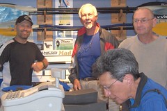
Anyone traveling the Trent near Bolsover has to go to Twigg’s Restaurant. Call from the lock beforehand to find out when the restaurant is open and what is being served that night. Over time, the kitchen has expanded out into the dining area. But, any couple who work over 90 hours a week each, have the right to, “cross the line,” a little. Mr. Twigg said his wife is so small she will never grow up to be a branch! Here we enjoyed some excellent pizza and some, “out on the limb,” conversation. ‘Trust us,” Mr. Twigg will remind you of one of your favourite movie stars!


Food supplies were running low. Luckily, we reached Fenelon Falls late the next afternoon and celebrated with salad, chicken and ice cream from the grocery store. The logistics of traveling by kayak requires that you unload everything at night and reload in the morning. This is not as easy as it sounds when dealing with numerous small items that have to be tucked into every inch of space in the bulkheads. Put something in a different spot and your concentration is ruined for the entire day. If we had not made Fenelon Falls that night it would have meant a messy mid-day repack while bobbing on the water.

Pretty Bobcaygeon came and went, so we thought. But, Pigeon Lake was our nemesis. Not only did we make a grave navigation error but the wind made it impossible to stay on the lake. Perhaps, we were a little short sighted in not carrying navigational charts of the canals with us. We were only relying on the pamphlet given out at the locks that shows a small scale map and a rudimentary channel route. After 4 hours of paddling we were still within site of the Bobcaygeon water tower. We were also, desperately trying to get our boats out of the pounding waves and up on a well manicured, private lawn. After landing, we walked down to a large mansion sitting in a beautiful location at the tip of a point. No one was home. The place looked like an abandoned resort in major disrepair but had the appearance that somebody occasionally lived there. Unable to go back on the water and taking advantage of the sailor’s credo, “any port in a storm,” we laid out in the mid-day sun and fell asleep. Thinking that someone would show up sooner or later, we made supper and set up our tents.
At dusk, the headlights of a pickup truck headed our way across the lawn. It was the caretaker, who welcomed us aboard the $15 million dollar property, “Sandy Point Resort.” He said that other events on the water had been cancelled and that we were lucky to be safe and dry. Considering how well, even adverse circumstances had worked out in our favour, we laid down that night in humble gratitude.

At the Lovesick Lock near Burleigh Falls, JR’s rudder cable broke. After a quick repair, with duct tape of course, he zoomed on to the next camp. Gord fixed the cable with some spare connectors he had brought along and the rudder held for the rest of the trip. Occasionally, we had to do an oil and lube job on the kayaks. This involved rubbing Gord’s rudder petals with olive oil and JR’s with WD40. Overall, the boats served us well, whether in big water or in wild wakes. What we found out was that the faster the power boats traveled the less wake they produced. Once they come down from plane you had to be aware of gigantic rolls. But above all, the biggest problem is being beached on shore when a raging wake comes in. The canoe could easily be swamped or the kayak cockpits’ filled up with water.

We encountered a lot of boats from the US: from New York to Texas and even from Arizona. One American was sailing the Trent and Great Lakes in preparation for a trip around the world. Being in the locks with the big yachts and catamarans was not intimidating at all. Sometimes we held onto their ropes but usually, we had an entire side of a lock to ourselves. Our first rest stop on Stony lake was at the historic, wood frame Anglican church, St. Peter’s on the Rock. While we were in the church it started to rain in torrents. We praised the Lord for keeping us dry and for opening up His house to the thankful, “Donkeys.” With everyone full of energy and good night sleeps, “The Donkey,” plugged on. Peanut butter and raisin wraps had long been given up for canned tuna, salmon salad, boiled eggs, fresh fruit and veggies. Smooth water, cloudy skies and good spirits were our welcome companions for the trip through Clear Lake and beyond.

The waterways throughout the Kawartha Lake section of the Trent are very spectacular. Every turn gives you another million dollar view. Dark blues and greens contrast with 3 story anodized windows that look over white, Carver yachts sitting in private bays. Luckily, due to our early morning starts, we missed most of the boat traffic. Sitting back on the grass at Youngs Point we decided to have a short day. The wind was picking up and the tourist atmosphere of the picturesque village pulled us in. On the flowing day, we had a relaxing paddle down the Otonabee River towards Peterborough.

Our canoe and kayaks were the only boats in the world famous lift lock. Gord was in front but couldn’t see over the high sides of the gigantic bath tub. In a short time, we were making a run for the last lock through Peterborough. Some severe looking clouds and a strong headwind had moved in to greet us. The lockmaster told us that if lightning started he would shut down the lock and leave us on our own. The other option was to use the canoe chute. All went well, the storm passed over and we got through the lock. Later that night, after we set up camp, we went back to examine the suicidal, canoe chute. It started at a concrete step about a foot out of the water and consisted of a series of steel rollers that ended at about two feet above a white water current. The current was flowing directly into the whirlpool turbulence of a 30’-0” high dam’s discharge. “Yes,” said the lock attendant, “lots of people take the chute.”

First, you would never get a loaded canoe up onto the rollers. Second, you would never stay upright after hitting the current. Third, you would drown after being sucked into the dam’s maelstrom. “Actually,” said the attendant, “I’ve never personally seen anyone take the chute.” We thought to ourselves, “and you have never seen anyone come out the other side either!”

We took our first day off since our journey began. We went to the Tub Club to do our laundry, had breakfast at Thurston’s and visited the Peterborough Canoe Museum. The front of the Museum is all boarded up with plywood and looks like it is closed. However, if you go around back, you’ll find an impressive entrance and a staff eager to answer your questions. Everything is there, from ancient dugouts to a newly built birch bark canoe. If you have any leanings toward the Liberal Party, Pierre Trudeau’s fringed, buckskin jacket with “Canada” across the back and the solo canoe that he was paddling in the famous Harrington Lake photograph, is on display. JR was in Liberal heaven! Back at camp, we were talking to an elderly couple who asked where we had started off from. We told them, “Manitoulin Island.” They said, “our son works there for the Little Current newspaper.” By shear coincidence, it was their son that had interviewed us before we left.

Bill and Iris have an addictive habit. They have to stop and light up their camp stove to make tea at every break and lunch stop. Consequently, their white gas supply was running low. There were no stores that we could find close to the water that sold white gas. This is another example where a basic need of long-haul paddlers can not be met. There just isn’t the demand for small retailers to carry white gas. We had all equipped ourselves with white gas stoves in order to share bottles and to be friendly to the environment by avoiding having to recycle propane cylinders. The Ontario Provincial Parks have now banned the small propane cylinders due to high disposal costs. Gord saved the day by magically producing 2 full Primus bottles. The first place that Bill was able to buy gas was at the Canadian Tire in Peterborough. It took an hour and half walk to get there. Hey, we’re modern day voyageurs and are used to turning little side trips like this one into positive outcomes. Swiss Chalet was along the way.

While we’re still discussing Bill, another anomaly came up. Bill wore the same shirt since we left Manitoulin Island! It seems that the liner inside his PFD was rubbing and melting his new Cloudveil shirt. Unwilling to risk ruining any other clothes, Bill religiously washed the same shirt every other day.
Now, while we’re thinking about water, the basic need of obtaining drinking water was not a problem. We all had water filters with us that we used along Georgian Bay. On the Rideau we bought bottled water since the water at the locks had to be boiled. On The Trent, you could drink the water. But, there was still one prime luxury missing. None of the locks provide showers. We soon became very adept at doing a rub down in the wash room and occasionally took a dip in the canal.

We had heard rumours that more people have drowned in Rice Lake than in any other lake in Ontario. We also knew from Bill and Iris’s previous Trent trip that there were very few places to land on the lake. One option was to leave Peterborough and stop half way down the lake at a former Provincial Park. The other option was to camp at the entrance to the lake and do the entire lake in one day. We didn’t have to decide. As we reached the end of the Otonabee River, threatening rain clouds had rolled in. We had to get off the water, fast! Practically, right beside us were the vacant, Rainbow Cottages. We pulled in and set up our tents and the dining shelter. The rain held off while the owner, Tony, opened up the sub-standard, toilet and shower facilities.

Within the hour, a heavy downpour let loose. But, we were eating supper in comfort inside the shelter and enjoying a delicious, Newfoundland Molasses Cake. A couple of new found, Newfie friends had given Bill and Iris the cake back in Peterborough. It was becoming extremely surreal how fortunate our trip was going! We renamed Rainbow Cottages, “Rainbow College,” in recognition of all the experience and good luck that we had been enjoying. No one was sore or tired. No one got wet or hungry. No one was homesick or upset. All our equipment was intact. Even wrong turns, heavy winds and potential rainstorms had turned into successful outcomes.

With a cool wind in our back, we did Rice Lake in one day. At Hastings, we caught up on the latest Conrad Black news, used the marina’s internet service, and went in search of ice cream. Although the paddle down the marshy shoreline of the Trent River did not offer the same majestic views of the Kawarthas, we had good times and good weather all the way.

While in one of the locks on the Trent River we encountered a group of, “original,” voyageurs. They were dressed in authentic outfits, complete with natural beards and were paddling 2 birch bark canoes. Through the canal grapevine we heard that they were coming. Their plan, in recognition of the 175 anniversary of the Rideau System, was to paddle a re-turn route to Ottawa. They were retracing our steps up the Trent-Severn and Georgian Bay to the French River. From there, through Lake Nipissing, down the Mattawa and the Ottawa, they hoped to be back home in 60 days. Already, they were 15 days out and looked a little despondent. “Bon voyage mes amies, salut!”
Bill and Iris had a trailer site at Island Park Resort, on the Trent for over 20 years. This part of the trip was their homecoming after being away for 8 years. They met some of their old friends, traded jokes and “fish stories.” We then planned for our assault on Trenton. At Glen Ross, the lock staff were outstanding. Not only did they pull our boats out of the water but they moved all our gear over to a camp site. One of the workers even provided us with well water that he had brought from home for that evening and for the next morning. The last lock on the Trent River would have been a cause for celebration if it was not for the slimy weeds, garbage, noisy train trestle and the extraordinarily long, concrete walls. In dismay, we went on to the City of Trenton, “painted the town,” and set up camp at Patrick’s Marina. We had made it from Port Severn to the Bay of Quinte in 16 paddling days.

4- The Bay of Quinte

4- The Bay of Quinte

The skies were very dark the next morning, fog had rolled in and it was very doubtful if we should start out. After about an hour on the water, we headed for a marine that was visible around the next point. Here, there were lots of small, sailing boats pulled up on the shore. Close to a military style building was a large, portable shelter complete with picnic tables underneath. We had landed at CFB Trenton. (Canadian Air Force Base, Trenton) The rain started to pour down in buckets. At any moment we thought that the Military Police would come into the shelter, handcuff us and take us away for questioning. Instead, when the Duty Sergeant arrived, he said we could stay until the storms passed. This part of the base, was the CFB Trenton Yacht Club and was open to both the public and the military. We took full advantage of the club for 2 days, including: showers, kitchen and rec. hall. For our meals we were allowed to go to the Yukon Galley where, for a modest price, we enjoyed delicious food, “air force style.” At the Galley, Bill spotted Chuck Strahl, the Federal Minister of Agriculture/Indian Affairs. After being introduced, we reminded him that we had seen his acting debut on the Rick Mercer Report. During the evening, the drone of Hercules aircraft taking off for Afghanistan disturbed our sleep. We will always be grateful to the Manager of the Yacht Club for his extraordinary hospitality and quiet patience while enduring our modest tales of the modern canoe routes.

Having been forced to take off the only, full day of our trip, due to bad weather, we were anxious to start traveling again towards the Bellville bridge. When packing up our tents and gear, JR had a visit from a commando squirrel. He ate right through the food, dry bag and was just about to get into some oatmeal bars. Even after having been chased away, the furry soldier kept planning terrorist attacks from about 4 ft. away.

We had no idea where we were going to camp along the Bay of Quinte. A far reaching goal was to make it to the Mohawk Park near Deseronto but, the longer we paddled the further the Bellville bridge moved away! Finally, we made it past the Bellville bridge and were in sight of the Telegraph Narrows bridge at highway 49. Here, we spotted a private trailer park and were soon paying our fee and climbing into our sleeping bags for the night. Although there had been a light headwind, it felt good to be out in open water, unrestricted by locks and weed lined shores.

In the early morning fog, we were off again and made excellent time down the channel towards Hay Bay. With a joyful paranoia telling us, not to turn up into Hay Bay, we missed the Adolphus Reach and ended up in the town of Picton. “The Donkey,” had to turn tail and trot back at double time in order to reach Adolphustown before supper. This area is known as one of the most scenic spots in Prince Edward County. The Lake on the Mountain, the Glenora ferry, Finkle Park and the Loyalist Parkway, add to the natural attractions. JR’s great, great grandparents were Empire Loyalists from New York who had settled here in the 1800’s. A photographic history of the family can be found in the reading room at the Lennox Addington Museum in Napanee. Although the Adolphustown Park is now private, we were charged only $10.00 for our site. This is the special rate for anyone who paddles or bikes in. Another special at the park, was the smell of cow manure in the evening and the friendly odour of skunk in the morning. We asked if there was any camping between the park and Kingston but were greeted with a polite, “No.” All we needed was a small piece of flat land to set up our tents. Quickly, we came to the conclusion that when non-paddlers are asked about available camping they think of water and hydro hooks-ups, washrooms and a Tim Horton’s. Fortunately, past Millhaven and into the North Channel, we came upon the Loyalist, Lighthouse Park.

Our paddle down the Reach and into the North Channel of Lake Ontario had been tremendous. At the start, the water was quite rough but, a strong wind was in our back and we made terrific time along the shoreline. There are extremely wide open sections from the channel out into the lake but, when traveling from the west, the land mass appears to blend into Amherst Island, that blends into Wolfe Island, to provide a false sense of protection. At Lighthouse Park we laid out our colourful fly sheets and tents on the flat rocks to dry in the sun. They looked like the parachutes from downed pilots who were signaling their position. Here, the long rifts of flat rock reminded us of Georgian Bay. Iris felt it was fitting that our last camp on the Bay of Quinte would again conjure up the same exhilarating feelings that we had felt at the start of our trip.

Although there was a Johnny-on-the-spot at the park we were not sure if we were allowed to camp overnight. Soon, a couple of women came along in a canoe. After sharing some paddling secrets they offered us their nearby sandy beach to camp on. Graciously, we refused. If questioned why we had set up our tents, all we would have to do is to show our degrees from Rainbow College and everything would be OK. Next, a kayaker dropped by. He was out having some open air fun. Yvon was impressed by what we had accomplished so far. We exchanged emails and gave him our blog site. After supper we heard a trampling noise coming through the park. Here was Yvon making his way down the rocks with a trunk-size cooler. He had brought us, out of the goodness of his heart, roast chicken, fries, coleslaw, ice cream, coffee, beer and pop! Thank you Yvon, you are one in a million and a major highlight of our trip. In an email from Yvon, after we got back home, he said that if he had holidays he would of joined us on the next part of our trip.
The paddle into Kingston was very enjoyable. A tailwind pushed us along over rolls and surf into the Flora McDonald Marina. Here, we had a leisurely stop for food, showers and laundry before heading up to the Kingston Mills Lock for the night. We were now on the Rideau after traveling over 850 km. in 33 days. The final leg of our journey had begun.

5- The Rideau Canal

5- The Rideau Canal (175th Anniversary)

One of the first things we noticed about the Rideau Canal was how friendly it was to canoes and kayaks. The “blue-locking-through” docks were made of wood and they were low enough to provide easy access. When the lock was filled, the water came up to within inches of the top. There was usually a basin between flight locks that could be used for a break or lunch stop. Actually, the basin was intended for war ships to turn around in, if need be, during emergencies. We figured, that when the canal was originally built, in 1832, there were a lot more smaller craft and trade canoes. The old canals’ specifications catered to a different crowd but they are still very capable of handing the large, “ocean liners,” of today. As a footnote, we met a enormous yacht, the “Captain Hook,” in Kingston, in Smiths Falls and again in Manotick. It seems that he wasn’t able to travel any faster than we were!

The Rideau is known to be full of weeds but as long as we stayed close to the channel, there were no problems. Hopefully, the river had been cleaned up to celebrate the 175th anniversary. This was not the case with the washrooms at Kingston Mills. They were the dirtiest that we came across in our entire trip. On the bright side, our timing when reaching lock after lock was phenomenal. Either the locks were wide open and waiting for us or we were in the next lift scheduled to go through.

Bill had called ahead to the Kingston Whig newspaper to see if they would send out a reporter to cover our story. Cub-reporter Brock wrote down the details but we don’t know if anything was ever printed. The weather was warmer than on the Trent but we still had cloud cover and the water was near-perfect. At Chaffeys Lock, near the gorgeous Opinicon Lake Resort, Bill had arranged to meet Mary and Rick Lyons, who publish the Ontario Travel Guides. Bill and Iris had been interviewed by Rick on their previous trip up the Trent 4 years ago. He was planning to insert our story into different outdoor magazines complete with flattering pictures. That night, Bill and Iris had another visitor. A determined and somewhat ferocious raccoon had come right inside the fly of their tent. Bill had to growl, on all fours like a bear, before the raccoon would leave.

There was a slight, side wind on Newboro and Big Rideau Lake. These lakes are larger than most boaters think and they can turn into fierce infernos under the right conditions. We were headed for Colonel By Island in the Big Rideau for the night. Luckily, one of the boaters who we had followed through the locks, came over with his charts to show us the way. He also brought over a stack of pancakes and a pitcher of home made maple syrup. The provincial park on Colonel By was closed for repairs. However, yachts were still mooring there and we took over a point of land with a million dollar view. Not only is Colonel By one of the most beautiful islands on the Rideau but it once held a celebrity resort that was frequented by Paul Anka and David Nevin. The winds started to come up that evening but had subsided by morning. At Rideau Ferry, after going under one of the lowest, swing bridges in the world, we stopped in for breakfast. They had never before heard of Bill’s request for a tub of ice cream desert with his bacon and eggs! Both Bill and Gord were wearing black nose shields, white Penaten cream and well-worn Tilly hats. At the restaurant, all eyes were on the strange looking pair while they picked out a new pair of, “pirate” sunglasses for Gord.

On our way into Smiths Falls it started to rain. This was the very first time we got wet. It rained for about an hour as we paddled across the Lower Rideau, through Poonamalie and into the Chocolate Capital of Canada. At the lock, as the ubiquitous exception to the rule, high concrete walls surrounding the camp site. After a slight misunderstanding, the lockmaster directed us to the Chamber of Commerce marina. Out luck was still holding strong, for here were low wooden docks, a covered picnic shelter, showers, and drinking water. That afternoon we walked to Hershey’s and loaded up on chocolate and Eat-Mores. Unfortunately, the Hershey’s plant is going to close in the near future. After returning to the marina, we found another tent set up close to ours. It was Mike, a student from Queens, who was biking home from Ottawa. We had a good technical conversation about bikes, canoes and kayaks. Recently, JR got an email from Mike. He had bought his own kayak and had just finished touring the entire Rideau System in 6 days. Mike was hooked!

To put things into perspective, it’s about an hour’s drive from Smiths Falls to Ottawa. It took us 2 days. We had a long paddle to Burritt’s Rapids. The passage through the Merrickville locks went like clockwork. Our next stop was going to be at Long Island and then into Ottawa. At Long Island the best camping was before, “locking through.” In the morning, the lockmaster put us through first and the cheerful Rideau lured us on past mansions and high rises. We were so close to Ottawa that JR could smell Stephaine Dion’s green socks!

The lock gates at Hog’s Back were wide open for us. It was now just a short run to our rendezvous point where we would take our paddles out of water for the last time. The arrival was a low key event. We immediately began to set up our tents just like we had 40 times before. A boater who had recognized us from the Peterborough lock came over to offer his congratulations. Our driver from Elliot Lake, Romeo, arrived late in the afternoon and we all went out for supper at Dow’s Lake. It was over! 1100 km. of crazy paddling and the “Donkey,” was retired to pasture. Until the next time … … …

6- Post Script

6- Post Script

All or parts of the this article can be used without permission as long as references are taken within context and that credit is given to the following sponsors:
Elliot Lake Retirement Living retireelliotlake.com
Manitoulin Wind and Wave at Kagawong, Manitoulin paddlemanitoulin.ca


While waiting for Romeo, we tried to quickly review what was the most memorable part of the trip and came up with the following responses.

Bill said he had often looked out at the water at Port Severn while driving down the 400 and wondered if he would ever paddle it. Now, he could yell out to Iris and say, “We did it!”
Iris said that she enjoyed Georgian Bay the best. The solitude and barren beauty of the remote islands were calling her back for another visit.
Gord said that he would never forget our first day out and the run to Heywood Island. What we learned on that day set us up for the rest of the trip.
JR said that the difference between sitting in the kayak in the basement during the winter to the actual experience of paddling down an early morning, fog lined coastline was totally overwhelming. The dream became a reality.

Monday, August 13, 2007

From

Hi JR and the rest of the spanish donkey's congrats on your completion of your trip! I met up with you guys in smith-falls doing a tour on my bicycle, just want to let guys know that I completed my kayaking of the rideau as well took me 6 days, but just wanted to thank you guys for talking me into it and for the very very helpfull tips you gave me. I hope you guys are planning your next trip because I am hooked as you guys must be as well. I am looking at touring around PEI island, would be pretty cool to complete an entire loop of a province. Heard of a solo woman completed it in 15 days. Anyways, Congrats again and thank-you for the tips..mike studli